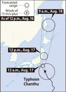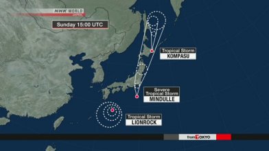
Typhoon Chanthu is expected to come close to the Kanto region around Tokyo and northern Japan between the evening of Aug. 16 and Aug. 17, bringing heavy rain to these areas, the Japan Meteorological Agency (JMA) said.
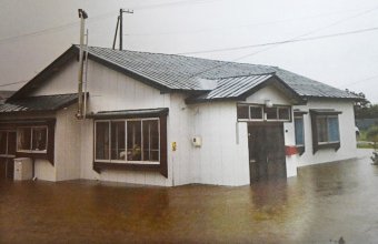
The JMA also warns of floods, landslides, swollen rivers and high waves in areas that will be affected by the typhoon.
As of noon on Aug. 16, the typhoon, this year's seventh, was situated about 190 kilometers east-southeast of Hachijo Island, south of Tokyo, and was moving north-northwest at about 25 kilometers per hour. The atmospheric pressure at its center is 990 hectopascals and it is packing winds of up to 20 meters per second at its center. The maximum instantaneous wind speed caused by the typhoon is 30 meters per second.
The typhoon is expected to come close to the Kanto region in the predawn hours of Aug. 17 and move north along the Tohoku region and Hokkaido.
The maximum amount of rain that is forecast to fall over a 24-hour period until noon on Aug. 17 is 250 millimeters in the Kanto and Tohoku regions and 150 millimeters in Hokkaido, according to the JMA.


